Alternatives to Light Pollution Map
200 apps like Light Pollution Map, closest match first.
Top picks
- T
Thestarmaps
LaunchThe Star Maps is a web tool for creating custom star maps. You pick a date, a time and a place, and the tool draws the stars, planets, Sun and Moon as they appear from that spot. You then apply a theme to change the colours and label fonts,
- S
SKY-MAP.ORG
LaunchSKY-MAP.ORG is an interactive map of the sky that runs in the browser. Set your location and local time to see the sky from where you are, follow news about supernovae and novae, and browse astro photos. The site is offered in 19 languages
- S
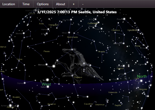
Skymap
LaunchSky Map Online is a free, browser-based star map. Pick a location and a time, and it draws the sky as you would see it from there: stars down to magnitude 12, the planets, the moon and deep-sky objects (DSO). You can zoom and pan around the
- S

Satellites
LaunchSatellites is a small web tool that tells you when you can see a satellite in the night sky from your location, without a telescope. You allow the site to use your location, or change it, and it shows when and where a satellite will appear
- N

Night Sky
LaunchNight Sky is a powerful AI personal planetarium. Quickly identify stars, planets, constellations and satellites above by simply holding your iPhone, iPad or Apple Watch to the Night Sky! This is all done magically. Whether you’re looking fo
- S

Starplot
LaunchStarplot is a Python library for drawing star charts and maps of the sky. You describe the observer, the time and the area you want, and it renders a chart in one of several types. Maps show an area of the sky in a chosen projection, horizo
Open source
More like Light Pollution Map


SuntimesWidget
Android app (and widget collection) that displays sunlight and moonlight times


Astrocartography Calculator
Free astrocartography maps with Swiss Ephemeris math and AI line readings





Horizon at 26.91962, 75.78781
The current sky at your approximate location, rendered as a CSS gradient







About Light Pollution Map
Light Pollution Map
Find dark sky spots and check Bortle ratings anywhere
Light Pollution Map is a satellite-based light pollution and dark sky finder. Click anywhere on the map to instantly see the local Bortle scale rating and approximate SQM sky brightness, then find nearby certified dark sky locations for stargazing.
- Price
- Free
- Category
- Utilities
- Website
- lightpollutionmap.io